Surveying
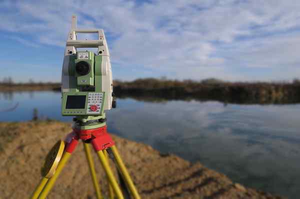
Topographical Land Surveys - The topographical surveys are carried out using the exceptionally high quality and extremely accurate Leica range of surveying equipment. All survey data collected is imported into AutoCAD based surveying software in order to create a professional survey which can then be exported in to most common file formats as required, or plotted out traditionally on paper in all regular sizes up to A0. Survey content can be tailored to suit your needs, from basic grid level surveys through to fully detailed and contoured terrain models, with all site features included.
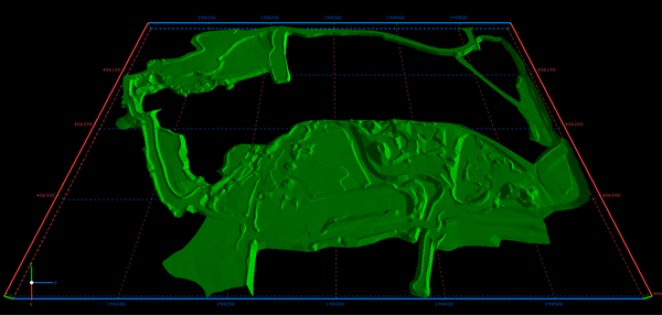
3D Ground Modelling - If you require detailed and accurate ground models for your project then get in touch with SPW Construction Engineering. I can create digital terrain models for all site developments, regardless of size, from small private dwellings through to large scale housing sites and commercial business parks. These models are extremely useful for earthwork cut and fill calculations and can be exported as a 3D image for visualisation and presentations.
Earthwork Calculations - Many of my clients have needed to know the quantity of material that their earthworks project will generate. Of course, SPW Construction Engineering has always been able to provide an accurate figure by utilising high performance ground modelling software to create accurate models of the project, faithfully reproducing the site features as they are, before work commences and how they will look after all earthworks have been completed. These two models can then be compared against each other to accurately compute the cut and fill earthworks volume for the project. The cut and fill zones of the project can then be exported to a printable drawing which will clearly highlight where they exist within the site boundary. No project is too large or too small for this and I pride myself on being able to produce a rapid answer to assist with your tendering.
Boundary Surveys - SPW Construction Engineering will carry out boundary surveys to a high standard of accuracy that will satisfy the requirements for submission to the Land Registry. All surveys can be related to the Ordnance Survey national grid and, also, overlaid with any existing Land Registry plans to highlight any discrepancies that may be the source of complaint. Need to take it a step further? No problem, SPW Construction Engineering has the capability and proven experience to act as your Expert Witness and provide and submit detailed surveys and reports as may be requested by the civil court.
Building Surveys - If you require accurate, detailed and fully dimensioned elevations and floor plans of your building then SPW Construction Engineering will be happy to produce these for you. All drawings can be produced on AutoCAD and, also, printed out on paper from size A4 to A0, as your needs require. I can also provide highly detailed individual plot surveys and landscaping plans which are invaluable for your own personal reference.